Moments in Kentucky
Legislative History

Presented by the Kentucky Historical Society

Munsell Map of Kentucky

An act passed by the General Assembly and approved February 4, 1817, provided a loan of $6,000 to Luke Munsell of Frankfort to encourage his completion of a map of Kentucky, described as “on a large and elegant scale . . . comprehending the limits of all the counties in the state, drawn from accurate and careful survey.” Munsell was to repay the loan with interest in three years. The map was published in 1818, but Munsell was unable to repay the loan, and the General Assembly in 1820 ordered the purchase of copies of the map that would be distributed to various state offices and other public institutions. The cost of these maps was to be deducted from the amount owed the state. Then in 1821, the General Assembly voted for Munsell to place fifty-three additional copies with the secretary of state, after which the remainder of the loan was to be relinquished and remitted.

A Map of the State of Kentucky by Luke Munsell, 1818.

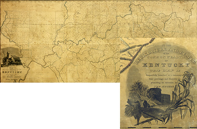
A Map of the State of Kentucky, From actual Survey. Also part of Indiana and Illinois, Compiled principally from Returns in the Surveyor General's Office by Luke Munsell, 1818. Prior to Munsell's map, Kentucky maps typically appeared in atlases or were foldouts in books. As Munsell's map was the first large (7.5 feet wide) wall map of Kentucky, its scale permitted far greater detail than any published previously. This scale, and Munsell's experience as a surveyor, rendered his map the most accurate of its day. KHS Collections.

Kentucky Unbridled Spirit

Kentucky Historical Society, 100 W. Broadway, Frankfort, KY 40601
502-564-1792 • history.ky.gov
An agency of the Kentucky Commerce Cabinet