Moments in Kentucky
Legislative History

Presented by the Kentucky Historical Society

Jackson Purchase

In 1818 Isaac Shelby and Andrew Jackson concluded a negotiation by which the Chickasaw Indians gave up all claims to land lying within Kentucky and Tennessee. The General Assembly passed an act, approved December 22, 1818, providing that no surveys should be made upon any portion of this land. The approximately two thousand square miles added to Kentucky as a result became known as the Jackson Purchase.

Map of the Jackson Purchase, 1885

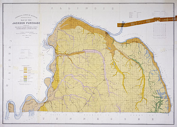
Map of the Jackson Purchase Comprising Ballard, McCracken, Marshall, Graves, Calloway, Hickman and Fulton Counties, published by the Kentucky Geological Survey, 1885. The Tennessee River, shown before Kentucky Dam formed Kentucky Lake, forms the eastern boundary of the Purchase. The township and range grid distinguishes this area from other Kentucky land records. A key to the numbering scheme for the land sections appears at top right, and the color codes for geologic soil types are at left. KHS Collections.

Kentucky Unbridled Spirit

Kentucky Historical Society, 100 W. Broadway, Frankfort, KY 40601
502-564-1792 • history.ky.gov
An agency of the Kentucky Commerce Cabinet